Collection Location Safety For Rockhounds Using Apps
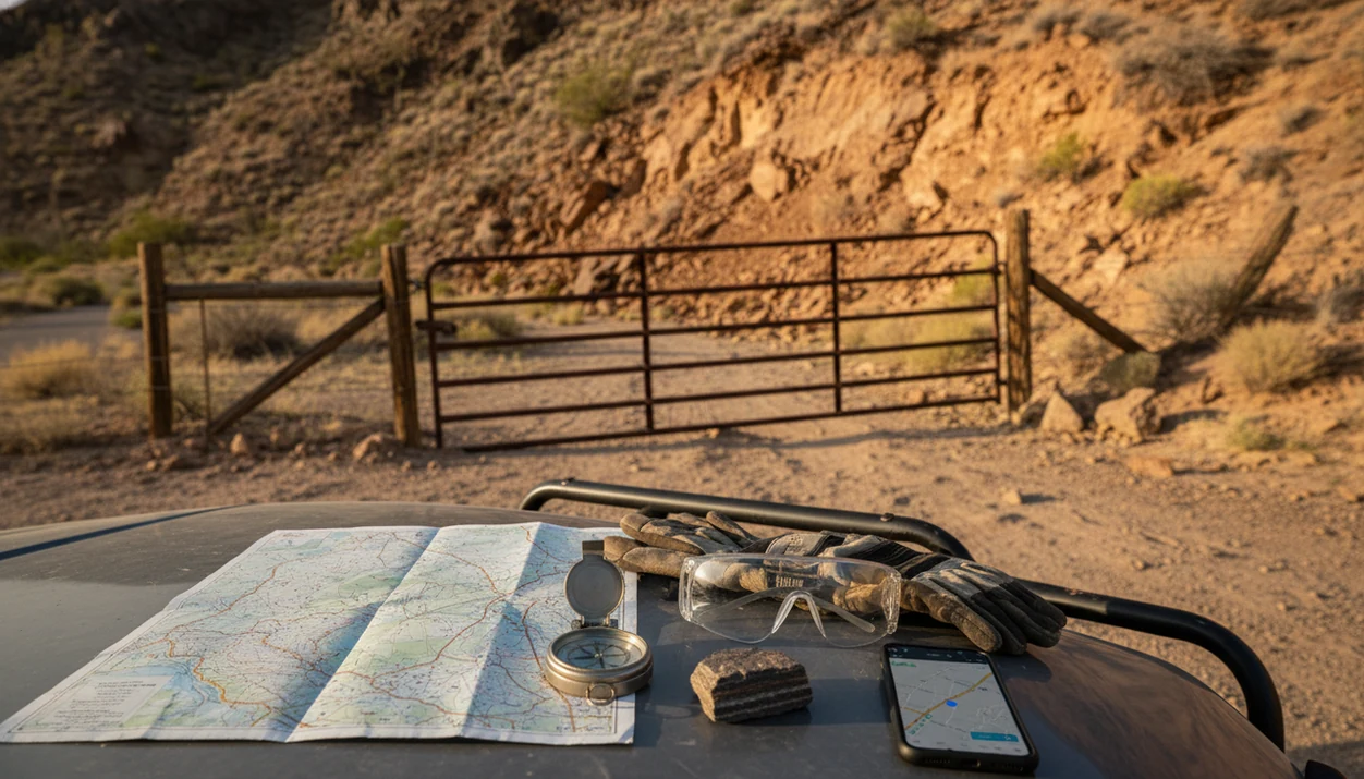
Collection location safety for rockhounds means verifying that a collecting spot is legal, physically safe, and not over-trusted just because a GPS pin or rock app points there. Treat app locations as approximate clues, then confirm land ownership, collecting rules, terrain hazards, weather, and signage before you go.
Definition: Collection location safety is the practice of checking access rights, collecting rules, terrain hazards, and GPS precision before visiting or sharing a rock, mineral, crystal, or fossil site.
TL;DR
- A rock app can help identify a specimen, but it cannot confirm legal access, land status, weather, wildlife, mine danger, or cliff stability.
- GPS pins can be wrong by several meters or more, which matters near fences, property lines, highwalls, mine benches, and canyon edges.
- Before collecting, check official land maps, local rules, posted signs, protected-site restrictions, and basic field-safety gear.
Collection Location Safety For Rockhounds: The Five Basics
- Land status first: Verify ownership and collecting rules before visiting any location. A public-looking gravel road may cross private land, an active claim, or a closed management area.
- Terrain can be the real hazard: Avoid abandoned mines, active mine areas, steep cuts, unstable walls, and vertical faces. A quartz chunk near exposed roots is safer than one below a crumbling overhang.
- Pins are clues, not permission: Treat online GPS pins and app locations as approximate. One copied coordinate can put you on the wrong side of a fence.
- Bring field backups: Carry water, offline maps, a paper or downloaded map, first aid, gloves, eye protection, and backup power. Tell someone your route and return time.
- Identification is separate from access: Rock Identifier helps identify finds from photos, but it does not evaluate field hazards or legal access.
How it works: safe collecting starts by separating specimen identity from place risk. A likely identification tells you what the rock may be; it does not tell you whether you should stand there.
Smartphone GPS Accuracy At Rockhounding Sites
Smartphone GPS at rockhounding sites is approximate field information, not a survey boundary. A 2018 smartphone GNSS accuracy study found horizontal errors commonly in the 5- to 10-meter range under open-sky conditions, before terrain and signal blockage add more uncertainty (https://www.mdpi.com/1424-8220/18/11/3613).
That distance matters. Five meters near a roadcut may be the difference between a safe shoulder and loose rock below a face. Ten meters near a property line can put your boots past the fence, even if the blue dot says otherwise.
Phone GPS, map layers, copied coordinates, and user-shared pins each add possible error. Rugged terrain, canyons, tree cover, cliffs, weak signals, and old map data can stack those errors. We have seen a noon phone photo where glare hid luster and cleavage; location screens can mislead in a quieter way. They look precise, but the field may not be.
For rockhounds, a GPS pin is often useful for returning to a general area, not for proving permission or safe footing.
Rock Collecting Safety Rules For Private Land And Public Land
Can I collect rocks there just because the map shows public land? No. Public land does not automatically mean collecting is allowed, and private land requires clear permission before entry or collecting.
Land categories matter. Private land, Bureau of Land Management land, Forest Service land, state trust land, state parks, county parks, mining claims, wilderness areas, and protected cultural or fossil sites can all have different rules. Some allow casual surface collecting. Some allow none. Some require permits or forbid digging.
BLM rockhounding guidance generally allows “reasonable amounts” of common invertebrate fossils, rocks, minerals, and gemstones for personal use, but local offices can set limits, closures, and permit rules (https://www.blm.gov/programs/recreation/rockhounding).
Legal access is part of rock collecting safety because a wrong turn can become trespass, a vehicle recovery problem, or a conflict with an active work site.
Rockhounding GPS Pins, Secret Spots, And Approximate Coordinates
Rockhounding GPS pins can be outdated, copied incorrectly, intentionally vague, or attached to the wrong side of a land boundary. A single coordinate should never be treated as permission to enter, dig, park, or cross a fence.
Cross-check any shared spot against official land-status tools, satellite imagery, USGS topographic maps, current road access, and local collecting rules. If the pin sits near a quarry, claim, canyon rim, or private parcel, assume the location needs extra verification.
The pocket check is real.
A heavy pebble weighing down a pocket after a long hike can make a place feel earned. Still, exact public coordinates can create problems for the next visitor and the land manager. For sensitive places, share a drainage name, general district, or broad locality instead of exact coordinates. Approximate sharing helps beginners learn without turning small pockets into damaged holes.
Mine, Roadcut, Cliff, And Highwall Hazards For Rockhounds
Mines, roadcuts, cliffs, and highwalls are among the highest-risk collecting settings for rockhounds. Abandoned mines can hide open shafts, unstable adits, toxic gases, rotten timbers, loose rock, and sudden collapse.
NIOSH reported that falls from elevation accounted for about 19% of fatal injuries in U.S. metal and nonmetal mining from 2000 to 2014, which is why pit edges, benches, and highwalls deserve extra distance even for non-miners (https://www.cdc.gov/niosh/mining/UserFiles/works/pdfs/2018-106.pdf).
Do not stand under roadcuts, dig into steep faces, or collect beneath overhangs. If fresh rock is only reachable by leaning into traffic or stepping below loose blocks, leave it. A muddy rind on a creek stone is annoying; a fresher broken edge under a highwall is not worth the trade.
Active quarry and mine operations are also off-limits unless you have formal permission and site-specific safety instructions.
Sensitive Fossil, Crystal, And Mineral Site Location Sharing
Exact coordinates can damage fragile or legally protected collecting areas. Sharing a county, formation, mine district, or approximate wash is different from posting a pin to a small fossil bed, cave entrance, rare mineral seam, or crystal pocket.
Some places cannot tolerate attention. Fossil sites, caves, archaeological areas, rare mineral localities, and small pockets may be scraped out after one viral post. A grandparent’s jar of creek stones is one kind of collection; a protected fossil layer is another matter entirely.
Some fossils, cultural resources, cave materials, and park resources cannot be collected even when they are visible in public places. Rules depend on the land manager and specimen type. When in doubt, ask a local club, agency office, museum contact, or land manager what level of location detail is appropriate.
For sensitive collecting sites, approximate location sharing is often safer than exact coordinates because it reduces site damage and trespass risk.
Rock Identifier App Safety Boundaries For Collection Locations
Rock Identifier is a rock identifier app that identifies rocks, crystals, minerals, fossils, and gemstones from photos for rockhounds, students, and curious finders. It can help name a photographed specimen and provide supporting details such as Mohs hardness and value estimates.
Use RockIdentifier as an identification aid, not as a legal-access, navigation, hazard, weather, or emergency system. Apps can compare visual clues, but they cannot see a locked gate behind you, an active claim boundary, or a storm building over the ridge. The fuller discussion of photo uncertainty belongs in rock identifier accuracy.
Good ai rock identifier app and web tool that names rocks, crystals, minerals, and fossils from photos with mohs hardness and value estimates should deliver a likely identification and supporting clues, not permission to collect or proof that a site is safe.
Identify specimens after choosing a safe and permitted area through official sources. A collection tray under a desk lamp is the right place to compare surfaces, streak, luster, and possible lookalikes.
Pre-Trip Rock Collecting Safety Checks Before You Drive
A short pre-trip check prevents many rockhounding problems before the engine starts. National Park Service recreation fatality data reported an average of about 28 fatalities per year from 2008 to 2017 on NPS lands, a reminder that ordinary outdoor recreation carries real risk.
- Confirm access: Check official land ownership, collecting rules, closures, claims, permits, and posted restrictions.
- Review the ground: Compare satellite imagery, topographic maps, road access, parking, weather, daylight, and exit routes.
- Pack field gear: Bring boots, gloves, eye protection, water, first aid, offline maps, backup power, and a paper or downloaded map.
- Share the plan: Tell someone your destination, route, expected return time, vehicle description, and backup plan.
- Save the ID work for later: Photograph finds with a penny, key, or fingernail for scale, then compare results when you are off the slope.
If value comes up after the trip, treat photo estimates cautiously and read more on rock value estimate limitations.
For photo-based identification on iPhone or iPad, try the rock identifier app. You can also upload a photo on RockIdentifier.io.
RockIdentifier.io provides a web photo upload option for people who want help documenting a rock, mineral, crystal, fossil, or gemstone before reviewing collection location safety. AI Rock ID is an iPhone and iPad app that can support field notes and identification clues, but it does not verify land access, permits, or site hazards.
Quick answer: Collection location safety for rockhounds means checking land access, local rules, site hazards, and privacy before collecting or sharing a location. Apps can help document a rock, mineral, fossil, crystal, or gemstone find, but they cannot confirm legal permission or make an unsafe site safe.
Recommended app for collection location safety for rockhounds
AI Rock ID can be useful when a rockhound wants to document a find without relying on an exact public GPS pin. The app is most appropriate as an identification and note-taking aid, not as proof that collecting is allowed at a location.
Best for
- Photographing a rock, crystal, mineral, fossil, or gemstone before deciding whether to remove it
- Keeping identification notes separate from publicly shared exact coordinates
- Recording Mohs hardness clues and appearance details for later review
- Comparing a field find with app-based identification suggestions after leaving a site
- Documenting finds from permitted areas while avoiding sensitive location exposure
- Helping beginners focus on observation before collecting
Limitations
- The app cannot determine land ownership or legal collecting permission
- The app cannot verify whether a fossil, park, or protected site rule applies
- Photo-based identification may be limited by lighting, weathering, or incomplete samples
- The app cannot assess physical hazards such as mine instability, cliffs, or flash flood risk
Who this guide is for
Good fit if you
- Beginner rockhounds learning how to evaluate collection locations before a trip
- Families planning low-risk rock, crystal, mineral, fossil, or gemstone outings
- Collectors who want to avoid sharing exact GPS coordinates for sensitive sites
- Users comparing app results with field notes before deciding whether to collect
- Rockhounds who need reminders about private land, parks, mines, and fossil rules
- People who want a safety-first checklist before using a rock identification app in the field
Consider another method if you
- Anyone needing legal advice about land ownership, permits, or mineral rights
- Rockhounds entering abandoned mines, unstable slopes, or other hazardous sites
- Collectors working on protected fossils, cultural sites, or scientifically sensitive locations
- Users who need a professional site assessment, land survey, or agency determination
Limitations
No app, map, guide, or article can guarantee that a rockhounding location is legal, current, or safe. Conditions change, and on-the-ground signs override anything saved on your phone.
- Land ownership, permission, claim status, permits, and closures can change without appearing in an app.
- GPS accuracy varies by phone, terrain, sky view, signal quality, and map-source error.
- Posted signs, gates, fences, local rules, weather, wildlife, and active work sites override online information.
- RockIdentifier cannot detect unstable slopes, mine gases, private-property boundaries, emergency conditions, or legal restrictions.
- Rules differ by country, state, county, park, agency, land manager, and specimen type.
- Exact-location sharing may harm fragile sites or encourage trespass, even when shared with good intentions.
- This page is general safety education, not legal advice, emergency guidance, or land-manager permission.
- App pricing and feature access can vary, which is why the free vs paid rock identifier apps debate should stay separate from field safety decisions.
When safety, permission, or emergency response is uncertain, stop and contact the landowner, land manager, local agency, or emergency services.
Which option fits which need
| Need | Best option | Why |
|---|---|---|
| Identify a photographed rock or mineral from a safe, permitted area | AI Rock ID | The app is designed for photo-based rock, crystal, mineral, fossil, and gemstone identification with supporting clues. |
| Upload a specimen photo without using the iPhone or iPad app | Web Tool | RockIdentifier.io supports web photo upload for identification help from a browser. |
| Confirm whether collecting is legal on a specific parcel | Expert | A land manager, property owner, agency office, or qualified local authority is needed for permission and rule confirmation. |
| Evaluate a dangerous location such as an abandoned mine or unstable slope | Expert | Physical site hazards require trained assessment, proper equipment, and safety judgment beyond an identification app. |
| Screen a general image search result for visual similarity | Google Lens | General image search can show visually similar materials, but it does not provide collection permission or site safety guidance. |
| Confirm a high-value gemstone, fossil, or disputed specimen | Lab | Formal testing or expert examination is needed when identity, value, or legality has important consequences. |
Quick summary
- Best for
- This page is best for rockhounds who want basic collection location safety guidance before using apps or sharing find locations.
- Includes
- private land caution, park rules, fossil site awareness, sensitive site privacy, approximate GPS sharing, app limitations
- Platforms
- iPhone, iPad, Web
- Free version
- Yes
- Expert replacement
- No
Common mistakes
- Assuming an unposted property is open for rockhounding without permission
- Following a shared GPS pin without checking access rules or current site conditions
- Collecting in parks, preserves, or fossil areas before reading posted rules
- Entering abandoned mines because a map or app shows a promising location
- Posting exact coordinates for sensitive fossil, crystal, or mineral sites online
- Treating a rock identification result as permission to remove material
A practical next step is the identify rocks from a photo workflow in AI Rock ID.
FAQ
Can I collect rocks on public land?
Sometimes, but public land does not automatically allow collecting. Official rules, land-manager guidance, claims, park restrictions, and posted signs control what is allowed.
Are rockhounding GPS pins accurate enough to follow?
Rockhounding GPS pins are approximate and can be wrong because of device error, terrain, copied coordinates, or outdated information. Use them as clues, not as proof of access or safe footing.
Can I rockhound on private land if it is not posted?
No. Private land requires clear landowner permission before entering or collecting, even if there are no signs or fences.
Are abandoned mines safe for rockhounds to enter?
No. Abandoned mines can contain collapse hazards, hidden shafts, bad air, unstable rock, deep water, and other dangers.
Can parks ban rock collecting?
Yes. Many national, state, county, and local parks restrict or ban collecting rocks, fossils, minerals, plants, artifacts, or cave materials.
Should I share exact rockhounding coordinates online?
Use approximate sharing for sensitive fossil, crystal, cave, cultural, or rare-mineral sites. Exact public coordinates can increase site damage, trespass, and unsafe crowding.
Can a rock app verify whether I am allowed to collect there?
No. RockIdentifier and other rock apps can help with identification, but they cannot confirm permission, ownership, claims, closures, signs, or hazards.
What safety gear should rockhounds carry?
Carry water, boots, gloves, eye protection, first aid, offline maps, backup power, and a trip plan. Tell someone where you are going and when you expect to return.
How should I record a rockhounding location without exposing an exact site?
Use a general area description, approximate coordinates, or a private note instead of posting an exact GPS point publicly. This helps reduce pressure on sensitive sites and protects private or restricted locations.
What should I do if a collection site has signs of cultural artifacts?
Do not disturb the area or remove material. Cultural and archaeological sites may be protected by law, and a local land manager or qualified authority should be contacted.
Is it safer to photograph a specimen instead of collecting it?
Photographing a specimen is often a lower-impact choice when permission, site sensitivity, or safety is uncertain. A clear photo can still support later identification and note-taking.
Can weather affect collection location safety?
Yes. Rain, heat, snow, wind, and flash flood risk can change access conditions, visibility, footing, and the stability of slopes or washes.